Current Weather @ 9:11 PM Clear skies Temp 68.7º Humidity 34% Winds W 0.0mph Max Gust 19.6mph
Todays Extremes High 83.9º Low 58.9º Rain 0.00" Rain Rate 0.000" per hr Snow 0.00" Season 55"
ALERTS (click alert for more info)
None at this time
Welcome
Username:

Password:


Remember me

[ ]
[ ]
SUPPORT SCM!
Support SCM by making a single or recurring donation.


ROADS AND TRAFFIC
Updated: 09:00 PM v2.5
Run Spr to Highland  (330): 21 mins  
Highland to Run Spr  (330): 21 mins  
Big Bear to Run Spr    (18): 22 mins  
Run Spr to Big Bear    (18): 22 mins  
Big Bear to Redlands  (38): 67 mins  
Redlands to Big Bear  (38): 67 mins  
Big Bear to Lucerne    (18): 36 mins  
Lucerne to Big Bear    (18): 37 mins  
=Light  =Moderate  =Heavy Traffic
Road Conditions Page: Click Here
Online
Guests: 250, Members: 1 ...
al van

most ever online: 3772
(Members: 27, Guests: 3745) on Feb 26 23: 07:51am

Members: 9405
Newest member: Sugarloafjp
Member's Birthdays:
Happy Birthday to:

Birthday Cake
Dian4BB
MountainBoys


Upcoming Birthdays:
Aug 09 eric
Aug 09 Mtngoat John⭐
Aug 10 BBLDarkStar
Aug 11 RosieRena
Aug 11 RustyShakleford
Aug 13 mbear
Incident Street View


NO MAP IS AVAILABLE NOT ENOUGH INFORMATION

THU AUG 7, 2025, 4:18 PM
IMPROVEMENT FIRE
SUGARLOAF
RIVERSIDE AVE SUGARLOAF
FI IMPROVEMENT FIRE IN SUGARLOAF - RIVERSIDE AVE SUGARLOAF
UNITS RESPONDING: 282 283 (BFA)
NOTES:
IMPROVEMENT FIRE (DISPATCH STAMP: THU 07 AUG 2025 16:16:27 )
WEATHER AT INCIDENT LOCATION: 80 DEGREES WITH 16% HUMIDITY. WINDS W AT 11 MPH. PRECIP: NONE
(SOCALMOUNTAINS.COM CAD v13.1)


PHOTOS & MAPS:  

SCM Incident Map
Incident Satellite Map
SCM Incident Map
Incident Street View


INCIDENT UPDATES: 0   


SCANNER AUDIO IS NOT AVAILABLE FROM THIS HOUR


Chatbox
You must be logged in to post comments on this site - please either log in or if you are not registered click here to signup


Kenai
20 minute(s) ago
Hey MToddy, I have noticed a bug that I have not seen before and they look like little moth's but skinny and maybe 3/8" long. I have a bug zapper in the yard that gets most of them. Is that what it looked like?

McToddy
35 minute(s) ago
Walking out of Vons , I noticed a ton of flying bugs congregating around the lights (I'm sure a number of them are flying inside) -- are those mayflies? They weren't mosquitoes, but looked like winged silverfish.

SCM ALERT🚨
2 hour(s) ago
From the San Bernardino National Forest:
#Gold Fire Evening Quick Facts
Date: August 7, 2025
Size: 1079 acres
Containment: 15%
Personnel: 791
@CALFIREBDU
As of August 07, 2025 at 06:53PM

McToddy
3 hour(s) ago
SCM .... Yeah I just wanted to mention it here in case people were wondering why not much is happening in our area... Yeah, the Canyon Fire really started to take off (1K acres in a couple of hours).... Gold Fire is doing pretty good in comparison

SCM ALERT🚨
4 hour(s) ago
[UPDATE]
SMOKE CHECK in CRESTLINE
Smoldering Log Behinds Goodwins Market. Units Can Handle.
DETAILS: [Click Here]

MountainDreamin
4 hour(s) ago
(...referencing Whac-a-Mole)

MountainDreamin
4 hour(s) ago
Well stated, SCM!

SCM ALERT🚨
4 hour(s) ago
@McToddy - Yes, they shifted a lot of aircraft over to the Canyon Fire. Most of the aircraft on the Canyon came from the Gifford Fire near Santa Maria. Its like a game of Whac-A-Mole.

SCM ALERT🚨
4 hour(s) ago
[INCIDENT DISPATCH]
TU /TRAFFIC COLLISION WITH UNKNOWN INJURIES IN BARTON FLATS - EB HWY MM BARTON FLATS
DETAILS: [Click Here]
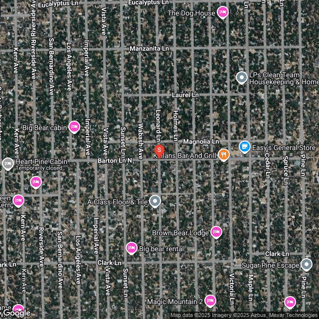
McToddy
5 hour(s) ago
Here's a link to the CalFire map of the Canyon Fire

[Click Here]

SCM ALERT🚨
5 hour(s) ago
[CHP DISPATCH] BIG BEAR - REPORTED FIRE 333 RIVERSIDE AVE 4:15PM [2] RR TIES ON FIRE IN FRONT OF NEIGHBORS R UPDATES: [Click Here]

McToddy
5 hour(s) ago
Interesting.... The Canyon Fire is on the CalFire map for the Gold Fire -- just scroll to the west.

Evac Warning & Evac Order and the fire footprint and tracking of some of the air assets are visible in the map

SCM ALERT🚨
5 hour(s) ago
[INCIDENT DISPATCH]
FI /IMPROVEMENT FIRE IN SUGARLOAF - RIVERSIDE AVE SUGARLOAF
DETAILS: [Click Here]

McToddy
5 hour(s) ago
Looks like air assets for the Gold Fire may have shifted to the Canyon Fire in Ventura County, east of Lake Piru

Baldwin67
7 hour(s) ago
I came up here after living in Moreno Valley 30 years. You mountain folk don't know how good you have it no matter where you live


Latest Forum Posts
Posted by SCM ALERT🚨 in NEWS
@CALFIREBDU:RT @SanBernardinoNF: #Gold Fire Evening Quick FactsDate: August 7, 2025Size: 1079 acresContainment: 15%Personnel: 791@CALFIREBDU (Aug 07 25: 07:12pm)

Posted by SCM ALERT🚨 in NEWS
@CALFIREBDU:[New Incident] Vegetation Fire reported in the area of Greenspot Roa (Aug 07 25: 02:32pm)

Posted by SCM ALERT🚨 in NEWS
From the San Bernardino National Forest: The Gold Fire Morning Update for Thursd (Aug 07 25: 11:19am)

Posted by SCM ALERT🚨 in NEWS
@CALFIREBDU:[New Incident] Vegetation Fire reported in the area of Cedar Street (Aug 07 25: 07:47am)

Posted by SCM ALERT🚨 in NEWS
@SBCOUNTYFIRE#SBCoFD units onscene of a vegetation fire at the 215 / 10 freeway (Aug 07 25: 01:29am)

Posted by SCM ALERT🚨 in NEWS
From the San Bernardino National Forest: #GoldFire Evening Quick Facts August 6, (Aug 06 25: 06:49pm)

Posted by SCM ALERT🚨 in NEWS
From the San Bernardino National Forest: **Correction**https://t.co/ 2fefv6vWZQA (Aug 06 25: 04:04pm)

Posted by SCM ALERT🚨 in NEWS
@SBCOUNTYFIRECounty Fire remains committed to assisting on #GoldFire with multip (Aug 06 25: 03:44pm)


(C)2002-2025 Socalmountains.com
All Rights Reserved
Privacy Policy Terms of Service
Contact Us

{THEMEDISCLAIMER}