Some of the Lightning Fires (Snags) Mapped
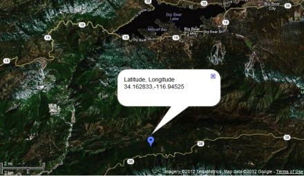
Benny ⭐, Sun Aug 12 2012, 04:07PM
Another snag reported...
Re: Some of the Lightning Fires (Snags) Mapped
Benny ⭐, Sun Aug 12 2012, 04:42PM
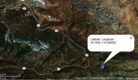
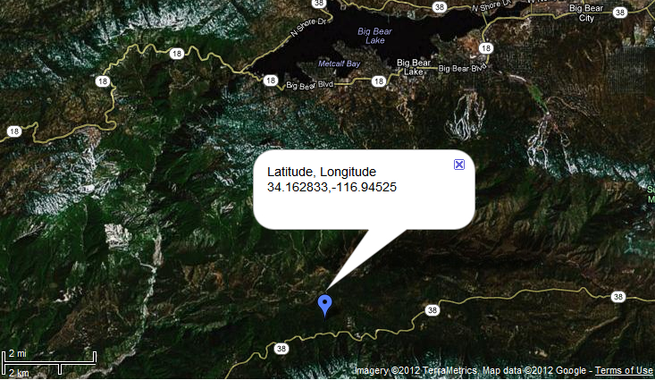
Here's the location of the Rainbow snag, off Rainbow IC.
Tree's on the ground and mopping up
Re: Some of the Lightning Fires (Snags) Mapped
Benny ⭐, Sun Aug 12 2012, 04:44PM
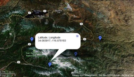
Vivian II Snag
Re: Some of the Lightning Fires (Snags) Mapped
Craig ⭐, Sun Aug 12 2012, 04:48PM
HERE IS A COMPLETE LIST OF LIGHTNING SNAGS SO FAR (COVERING THE LAST 3 DAYS)
August 9
Hog - 12:01 pm - near Hog Lake Road Forest Road 6S18 Thomas Mountain Area - 5'x5' spot - fire knocked down
Peak - 12:41 pm - 1 mile north of Morton Peak Lookout on Forest Road 1N12 - 1/10 acre
Oaks - 1:11 pm - near mile marker 22 near Glass Road east of Angelus Oaks - 10'x10' spot - one lane of Hwy 38 was closed temporarily
Slide - 1:48 pm - near Slide Peak
Flats - 2:29 pm - near Barton Flats
Tahquitz - 2:33 pm - Near Camp Tahquitz near Barton Flats
Filaree - 2:49 pm - Forest Road 1N09 approx 1 mile north of Angelus Oaks - false alarm
Cedar - 2:58 pm - Camp Cedar Falls Area east of Angelus Oaks
Hunting - 3:18 pm - North side of Thomas Hunting Grounds off Forest Road 1N12 west of Angelus Oaks
Keller - 3:58 pm - east side of Bear Creek Drainage
Bear - 4:02 pm - west side of Bear Creek Drainage
Holcomb - 7:19pm - upper Holcomb Valley - 20 x 20 spot
August 10
Stockton - 10:32 am - Stockton Flats area above Lytle Creek - 1/4 acre
August 11
River - 12:05 pm - east of Seven Oaks Resort on River Road - fire is believed to be out
Forsee - 1:11 pm - Forsee Creek Trailhead near Barton Flats - single snag on fire
Constance - 1:38 pm - Forest Road 1N12 in the Angelus Oaks area
Schneider - 3:47 pm - Forsee Creek near Barton Flats - single snag
Momyer - 4:40 pm - near Momyer Trail, San Gorgonio Wilderness - 1 snag and 10x10 spot on ground
Vivian - 5:36 pm - near Vivian Creek Trail, San Gorgonio Wilderness - 2 snags
San Savine - 5:51 pm - near San Sevaine Road, Front Country Ranger District
August 12
Sugarloaf - 8:23 am - Pinyon Area on the San Jacinto Ranger District - 20x20 spot - fire contained
Telegraph - 9:58 am - near Telegraph Peak in the Cucamonga Wilderness - 20x20 spot
Rainbow - 12:20 pm - near Onyx Summit along Hwy 38
Poopout - 5:00pm - Near Poopout Hill Trail - Single Tree
Re: Some of the Lightning Fires (Snags) Mapped
heyjude, Sun Aug 12 2012, 05:47PM
You guys are awesome!! Good job!!
Re: Some of the Lightning Fires (Snags) Mapped
Benny ⭐, Sun Aug 12 2012, 05:50PM
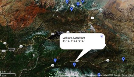
Latest snag...
Re: Some of the Lightning Fires (Snags) Mapped
SCM ALERT🚨, Sun Aug 12 2012, 05:51PM
Jumper 52 (smoke jumper aircraft) doing a recon of the forest reporting the latest snag (just above this message).
Re: Some of the Lightning Fires (Snags) Mapped
Benny ⭐, Sun Aug 12 2012, 05:52PM
This is no time for fishing!

Re: Some of the Lightning Fires (Snags) Mapped
Craig ⭐, Mon Aug 13 2012, 06:52PM
Updated Fire List (Adding August 13th):
August 13
26. Windy - 1:49pm - south side of State Highway 111 - west of Palm Springs - more info at: [Click Here]
27. Marion - 3:39pm - on Marion Ridge north of Idyllwild
Benny ⭐, Sun Aug 12 2012, 04:07PM
Another snag reported...
Re: Some of the Lightning Fires (Snags) Mapped
Benny ⭐, Sun Aug 12 2012, 04:42PM
Here's the location of the Rainbow snag, off Rainbow IC.
Tree's on the ground and mopping up

Re: Some of the Lightning Fires (Snags) Mapped
Benny ⭐, Sun Aug 12 2012, 04:44PM
Vivian II Snag

Re: Some of the Lightning Fires (Snags) Mapped
Craig ⭐, Sun Aug 12 2012, 04:48PM
HERE IS A COMPLETE LIST OF LIGHTNING SNAGS SO FAR (COVERING THE LAST 3 DAYS)
August 9
Hog - 12:01 pm - near Hog Lake Road Forest Road 6S18 Thomas Mountain Area - 5'x5' spot - fire knocked down
Peak - 12:41 pm - 1 mile north of Morton Peak Lookout on Forest Road 1N12 - 1/10 acre
Oaks - 1:11 pm - near mile marker 22 near Glass Road east of Angelus Oaks - 10'x10' spot - one lane of Hwy 38 was closed temporarily
Slide - 1:48 pm - near Slide Peak
Flats - 2:29 pm - near Barton Flats
Tahquitz - 2:33 pm - Near Camp Tahquitz near Barton Flats
Filaree - 2:49 pm - Forest Road 1N09 approx 1 mile north of Angelus Oaks - false alarm
Cedar - 2:58 pm - Camp Cedar Falls Area east of Angelus Oaks
Hunting - 3:18 pm - North side of Thomas Hunting Grounds off Forest Road 1N12 west of Angelus Oaks
Keller - 3:58 pm - east side of Bear Creek Drainage
Bear - 4:02 pm - west side of Bear Creek Drainage
Holcomb - 7:19pm - upper Holcomb Valley - 20 x 20 spot
August 10
Stockton - 10:32 am - Stockton Flats area above Lytle Creek - 1/4 acre
August 11
River - 12:05 pm - east of Seven Oaks Resort on River Road - fire is believed to be out
Forsee - 1:11 pm - Forsee Creek Trailhead near Barton Flats - single snag on fire
Constance - 1:38 pm - Forest Road 1N12 in the Angelus Oaks area
Schneider - 3:47 pm - Forsee Creek near Barton Flats - single snag
Momyer - 4:40 pm - near Momyer Trail, San Gorgonio Wilderness - 1 snag and 10x10 spot on ground
Vivian - 5:36 pm - near Vivian Creek Trail, San Gorgonio Wilderness - 2 snags
San Savine - 5:51 pm - near San Sevaine Road, Front Country Ranger District
August 12
Sugarloaf - 8:23 am - Pinyon Area on the San Jacinto Ranger District - 20x20 spot - fire contained
Telegraph - 9:58 am - near Telegraph Peak in the Cucamonga Wilderness - 20x20 spot
Rainbow - 12:20 pm - near Onyx Summit along Hwy 38
Poopout - 5:00pm - Near Poopout Hill Trail - Single Tree
Re: Some of the Lightning Fires (Snags) Mapped
heyjude, Sun Aug 12 2012, 05:47PM
You guys are awesome!! Good job!!
Re: Some of the Lightning Fires (Snags) Mapped
Benny ⭐, Sun Aug 12 2012, 05:50PM
Latest snag...

Re: Some of the Lightning Fires (Snags) Mapped
SCM ALERT🚨, Sun Aug 12 2012, 05:51PM
Jumper 52 (smoke jumper aircraft) doing a recon of the forest reporting the latest snag (just above this message).
Re: Some of the Lightning Fires (Snags) Mapped
Benny ⭐, Sun Aug 12 2012, 05:52PM
This is no time for fishing!
Re: Some of the Lightning Fires (Snags) Mapped
Craig ⭐, Mon Aug 13 2012, 06:52PM
Updated Fire List (Adding August 13th):
August 13
26. Windy - 1:49pm - south side of State Highway 111 - west of Palm Springs - more info at: [Click Here]
27. Marion - 3:39pm - on Marion Ridge north of Idyllwild